
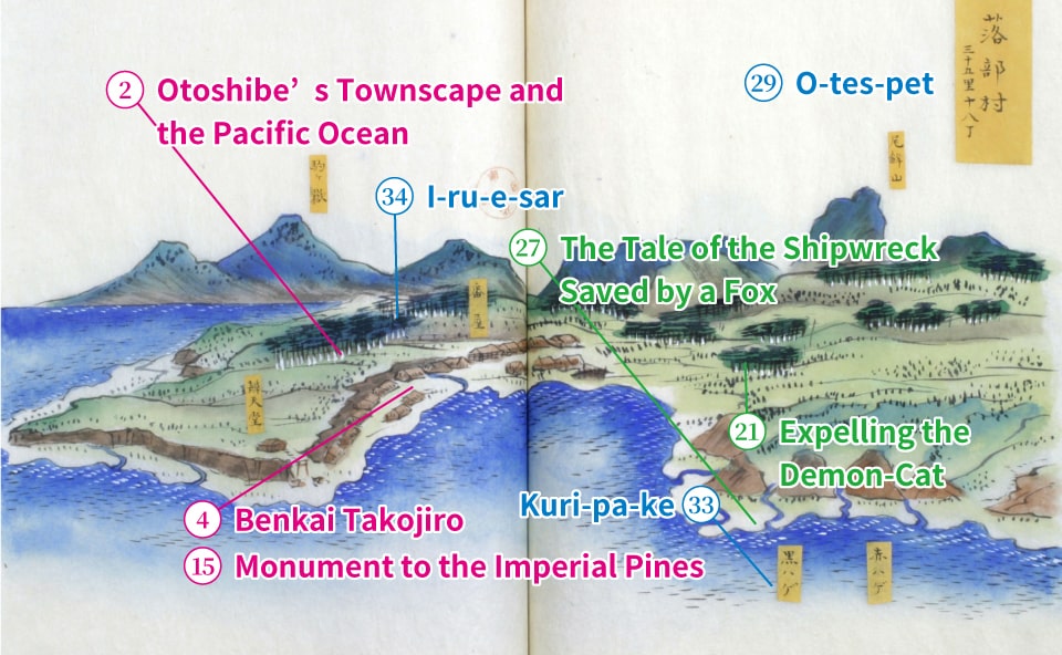
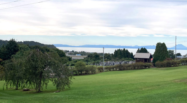
Otoshibe’s Townscape and the Pacific Ocean
Otoshibe Park
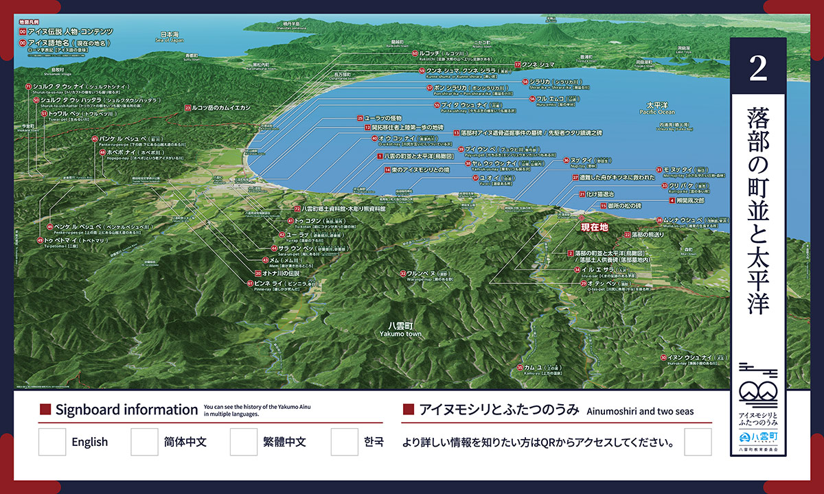
MAP No.2 [Otoshibe Park/Otoshibe’s Townscape and the Pacific Ocean Bird’s-eye View Signboard]
Otoshibe Park, located on a high hill that overlooks Funka Bay and the downtown area of Otoshibe, boasts a total of 5,000 azaleas in eight varieties, from early bloomers to late-flowering types, which combine with the park’s cherry blossom trees to offer a rich display of color to the delight of visitors.

Bird’s-eye View of Ainu Language Place-names
Muna-us-pet
Monashibe, Sakaehama
Place where weeds grow tall
O-tes-pet
Otoshibe
Place where fish traps are set at the river mouth
Inun-us-nay
Inu-nushi
River with a fishing hut
Mo-nup-tay
Monotai
Small, flat hillside/forest
Warunpe-nup
Warabino
Bracken meadow
Kuri-pa-ke
Kurohage
Place with many clouds
I-ru-e-sar
Irisawa
Field of cogon-grass with bear footprints
Kamu-yu
Kaminoyu
Upper hot springs
Nup-tay
Nodaoi
Wild woods
Yu-o-i
Yui
Place with a hot spring
Yam-uk-us-nay
Yamakoshi,Yamakoshinai
Marsh where chestnuts are always gathered
Puy-un-pet
Byuhi River, Buyube
River where there are always marsh-marigolds
O-u-kot-nay
Okutsunai River
Marsh where the river mouths join together
Tu-kotan
Atsuta, Tokotan
Place where there was once a Kotan
Yu-rap
Yurappu River, Yurappu
River where a hot spring flows downstream
Mem
Memu River
Place where a spring bubbles forth
Sara-un-pet
Saranbe River, Saranbe
River at the tail (due to being the furthest downstream of the branches the Yurappu River)
Panke-ru-pes-pe
Namari River
Lower route / River with a lower crossing over mountains
Penke-ru-pes-pe
Penkerupeshupe River
Upper route / River with an upper crossing over mountains
Hopepo-nay
Hopepo River
Place where an Ainu elder named Hopepo lives
Tu-petoma-i
Tobetomari
Forked path
Shuruk-ta-ush-hattar
Shuruk-ta-ush-hattar
Pool where aconite roots are always gathered
Tuwar-pet
Towarubetsu River
Lukewarm river
Pui-ta-ush-nay
Hanaura
Marsh where marsh-marigold roots are always gathered
Huru-emko
Yamazaki
Half a hill
Pon-shirar'ika=Pon-shirara-ika
Pon-Shirarika River
Small overflowing river
Shirar'ika=Shirara-ika
Shirarika River
Overflowing river
Kunne-shuma or Kunne-shirara
Kuroiwa
Black rock
Rukotchi
Rukotsu River
Footprints / There are footprints leading to the Great Bear mountain
Pinne-ray
Binnira / Kasuga
Where a stag died
Shuruk-ta-us-nay
Shuruk-ta-us-nay
Marsh where aconite roots are always gathered
Late Edo Period Bird’s-eye View of Otoshibe Area (O-tes-pet)
You can view a bird’s-eye view from the late Edo period.The image will scroll horizontally.
■Otoshibe’s Townscape and the Pacific Ocean
Irisawa 360, Yakumo-cho, Futami-gun, Hokkaido 049-2564
Otoshibe Park
Approx. 14 mins walk from JR Otoshibe Station