
Yakumo’s Townscape and the Pacific Ocean
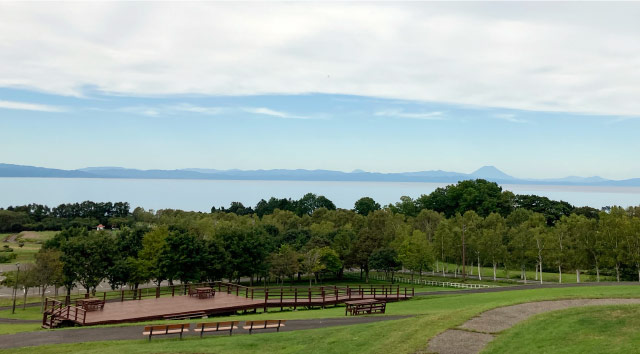
Funka Bay Panorama Park
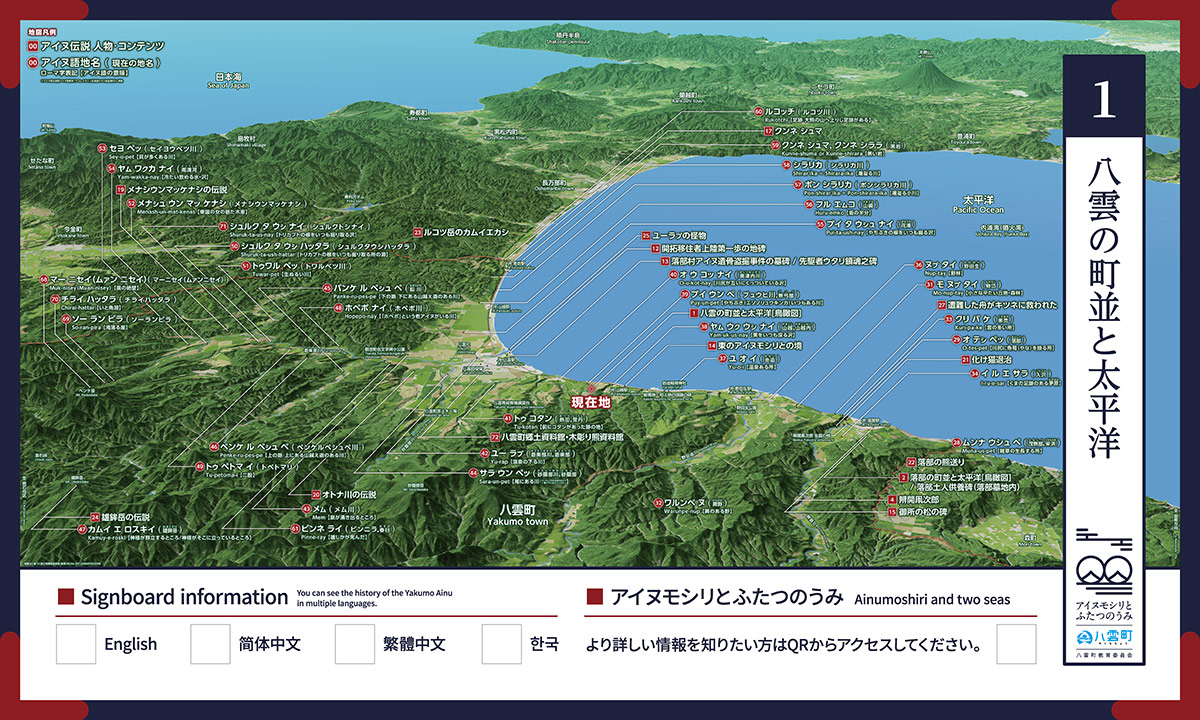
MAP No.1 [Funka Bay Panorama Park/Yakumo’s Townscape and the Pacific Ocean Bird’s-eye View Signboard]
Located on the gentle hillside that overlooks Funka Bay, this park was opened with the aim of enabling visitors to enjoy outdoor attractions. With a main area that includes a park golf course and unique play equipment, this is a resort park that offers fun for all the family. In addition, the Panorama Hall, where a variety of information about the park is provided, also features a “Kids Arena” and a snack corner so that even rainy days can be enjoyed here.

Bird’s-eye View of Ainu Language Place-names
Muna-us-pet
Monashibe, Sakaehama
Place where weeds grow tall
O-tes-pet
Otoshibe
Place where fish traps are set at the river mouth
Mo-nup-tay
Monotai
Small, flat hillside/forest
Warunpe-nup
Warabino
Bracken meadow
Kuri-pa-ke
Kurohage
Place with many clouds
I-ru-e-sar
Irisawa
Field of cogon-grass with bear footprints
Nup-tay
Nodaoi
Wild woods
Yu-o-i
Yui
Place with a hot spring
Yam-uk-us-nay
Yamakoshi,Yamakoshinai
Marsh where chestnuts are always gathered
Puy-un-pet
Byuhi River, Buyube
River where there are always marsh-marigolds
O-u-kot-nay
Okutsunai River
Marsh where the river mouths join together
Tu-kotan
Atsuta, Tokotan
Place where there was once a Kotan
Yu-rap
Yurappu River, Yurappu
River where a hot spring flows downstream
Mem
Memu River
Place where a spring bubbles forth
Sara-un-pet
Saranbe River, Saranbe
River at the tail (due to being the furthest downstream of the branches the Yurappu River)
Panke-ru-pes-pe
Namari River
Lower route / River with a lower crossing over mountains
Penke-ru-pes-pe
Penkerupeshupe River
Upper route / River with an upper crossing over mountains
Kamuy-e-roski
Mount Obokodake
Place with a standing group of gods.
Place where the gods stand.
Tu-petoma-i
Tobetomari
Forked path
Shuruk-ta-ush-hattar
Shuruk-ta-ush-hattar
Pool where aconite roots are always gathered
Tuwar-pet
Towarubetsu River
Lukewarm river
Menash-un-mat-kenas
Menash-un-mat-kenas
Woodland plain where there were women from the East
Sey-o-pet
Seiyobetsu River
River where there are many shells
Yam-wakka-nay
Nanmakka
Cold, drinkable water/marsh
Pui-ta-ush-nay
Hanaura
Marsh where marsh-marigold roots are always gathered
Huru-emko
Yamazaki
Half a hill
Pon-shirar'ika=Pon-shirara-ika
Pon-Shirarika River
Small overflowing river
Shirar'ika=Shirara-ika
Shirarika River
Overflowing river
Kunne-shuma or Kunne-shirara
Kuroiwa
Black rock
Rukotchi
Rukotsu River
Footprints / There are footprints leading to the Great Bear mountain
Pinne-ray
Binnira / Kasuga
Where a stag died
Muk-nisey(Muan-nisey)
Muk-nisey (Muan-nisey)
The far precipice
So-ran-pira
So-ran-pira
Cliff where a waterfall flows
Chirai-hattar
Chirai-hattar
Stringfish pool
Shuruk-ta-us-nay
Shuruk-ta-us-nay
Marsh where aconite roots are always gathered
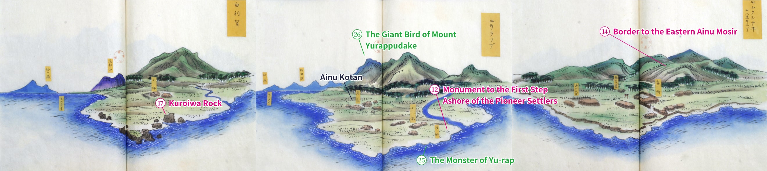
Late Edo Period Bird’s-eye View of Yakumo Area (Yu-rap)
You can view a bird’s-eye view from the late Edo period. The image will scroll horizontally.
■Yakumo’s Townscape and the Pacific Ocean
Hamamatsu 368-8, Yakumo-cho, Futami-gun, Hokkaido 049-3124
Funka Bay Panorama Park
Approx. 10 mins by car from JR Yakumo Station